Wolston Estate

In 2010 I helped Meg Gordon and the Centenary Suburbs Historical Society (www.cshsoc.org.au) by drawing the maps for their book “Pastoralists of Brisbane Town’s Fringe / Pioneers of Seventeen Mile Rocks and Wolston.”

At the time I lived in the centre of this map.

Wolston Estate
Wolston Estate

When River Was Roadway

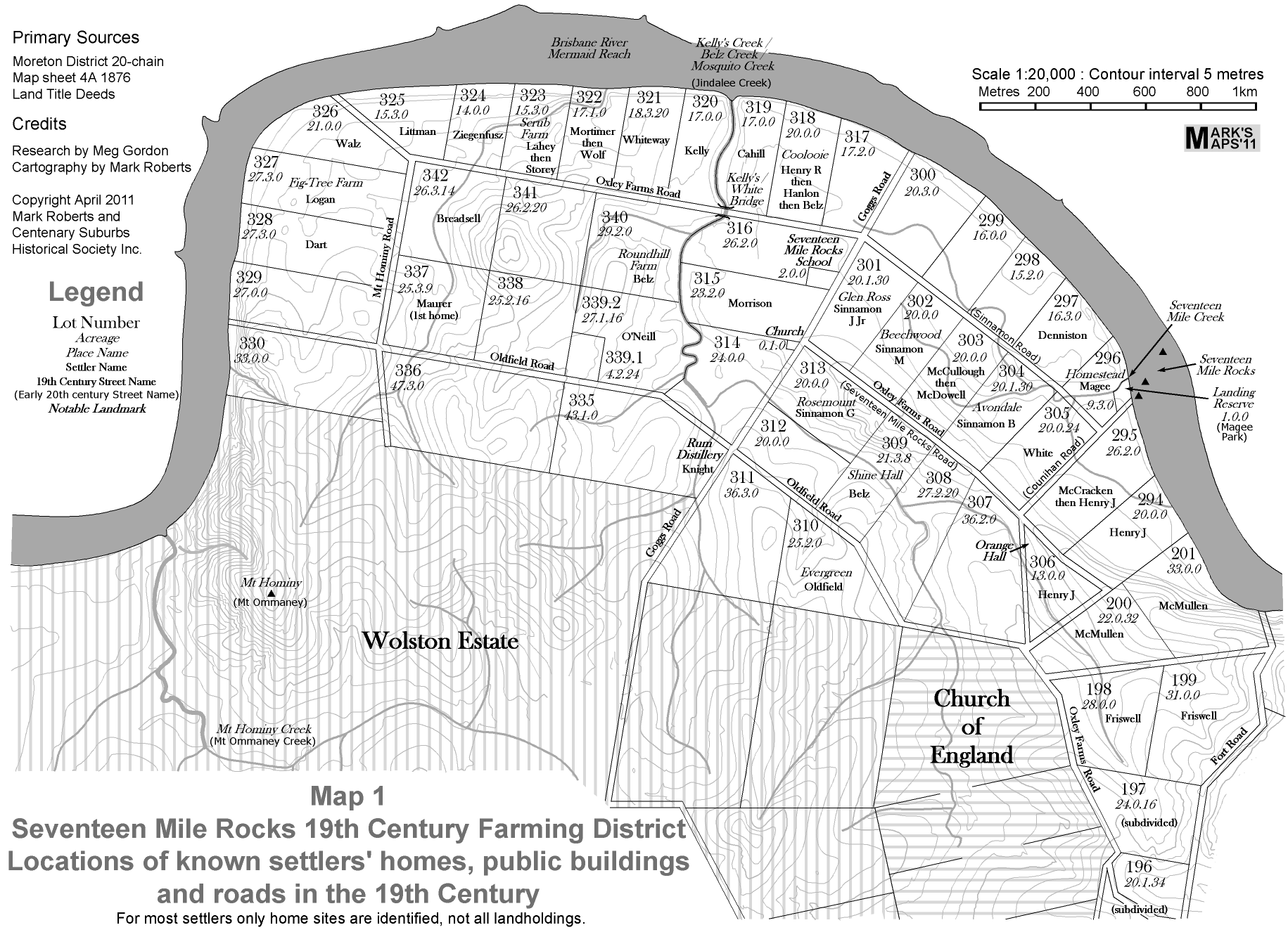
In 2011 I collaborated again with Meg Gordon and the Centenary Suburbs Historical Society (www.cshsoc.org.au) by drawing the maps for their impressive publication “When River Was Roadway”, subtitled “Pioneer Farmers of Brisbane’s Seventeen Mile Rocks District”.

It is a monochrome publication, and I went with a not so subtle “old world” feel to the typography where it referred to older features and a more modern look for modern features. Here is one of several maps which appear in the book:

Settlers Homes
Settlers Homes